Maps & GPS
Know Before You Go: Trail Navigation Tips for West Bragg Creek
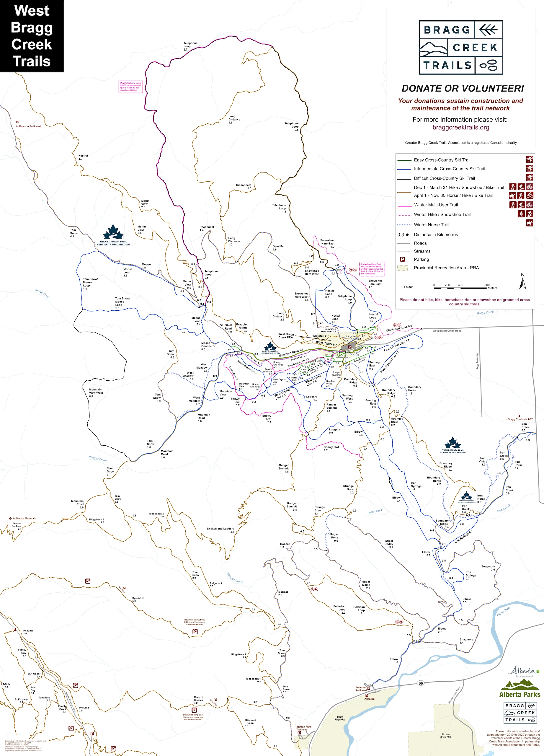
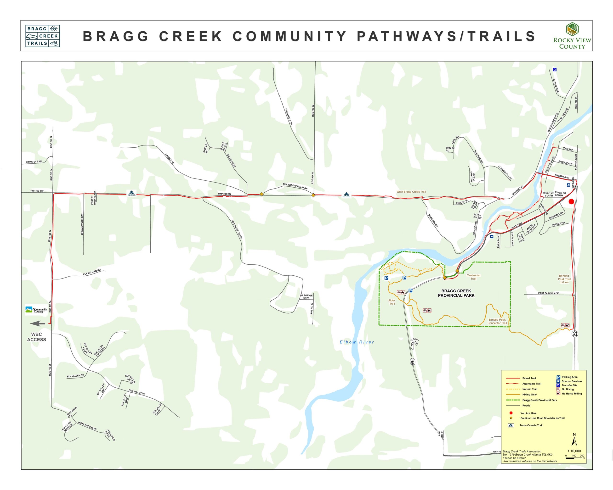
With 166 km of trails spread across thousands of acres, West Bragg Creek is vast, beautiful and easy to get turned around in. While BCT has installed signage at both trailheads and at key junctions, we strongly recommend planning ahead. Print or download a map before your visit or better yet, install a GPS app on your phone. (Heads up: there’s no cell service or Wi-Fi at the trailhead!)
This page is sponsored by:
Downloadable Trail Maps
Do your wayfinding with Mobile GPS Apps
Install BEFORE you arrive as there is no cell service at the trailhead. Note that your mobile GPS works throughout our trail network even where there is no cell signal. Also, ,most of the free versions of these apps will save a map ONLY for the region you are in when you download and install them. For example if you install Trailforks anywhere in Alberta, you will get all Alberta trails on the free version. When you get out to West Bragg Creek, your GPS should show your live location, exactly where you are on the downloaded/default map. If you are just an occasional user, the free versions should suffice, you don’t need to create a user profile or give a credit card number to the app developer.


